Subsurface Utility Locating
What is Subsurface Utility Designating?
Subsurface Utility Designating is a combination of techniques used for locating and mapping subsurface utilities. These processes reduce the risks associated with constructing near underground utilities. Based on Subsurface Utility Engineering (SUE) protocol set forth in ASCE Guidance 38-02, our typical utility survey approach includes record searches, site reconnaissance, geophysical surveys, and vacuum excavation. Vaccuum excavation is a drilling technique which uses high pressure air to remove soil without harming subsurface structures.
We work closely with project surveyors to generate drawings that depict the horizontal and vertical positions of utilities.
Quality Levels
The use of quality levels in the SUE process allows engineers to prepare plans with a specified level of accuracy and comprehensiveness. The four quality levels from lowest to highest accuracy are:
- QLD – Compiling information from utility records
- QLC – Verifying records by mapping observable utility features
- QLB – Conducting geophysical surveying to further verify locations of known utilities and identify potential unknown utilities
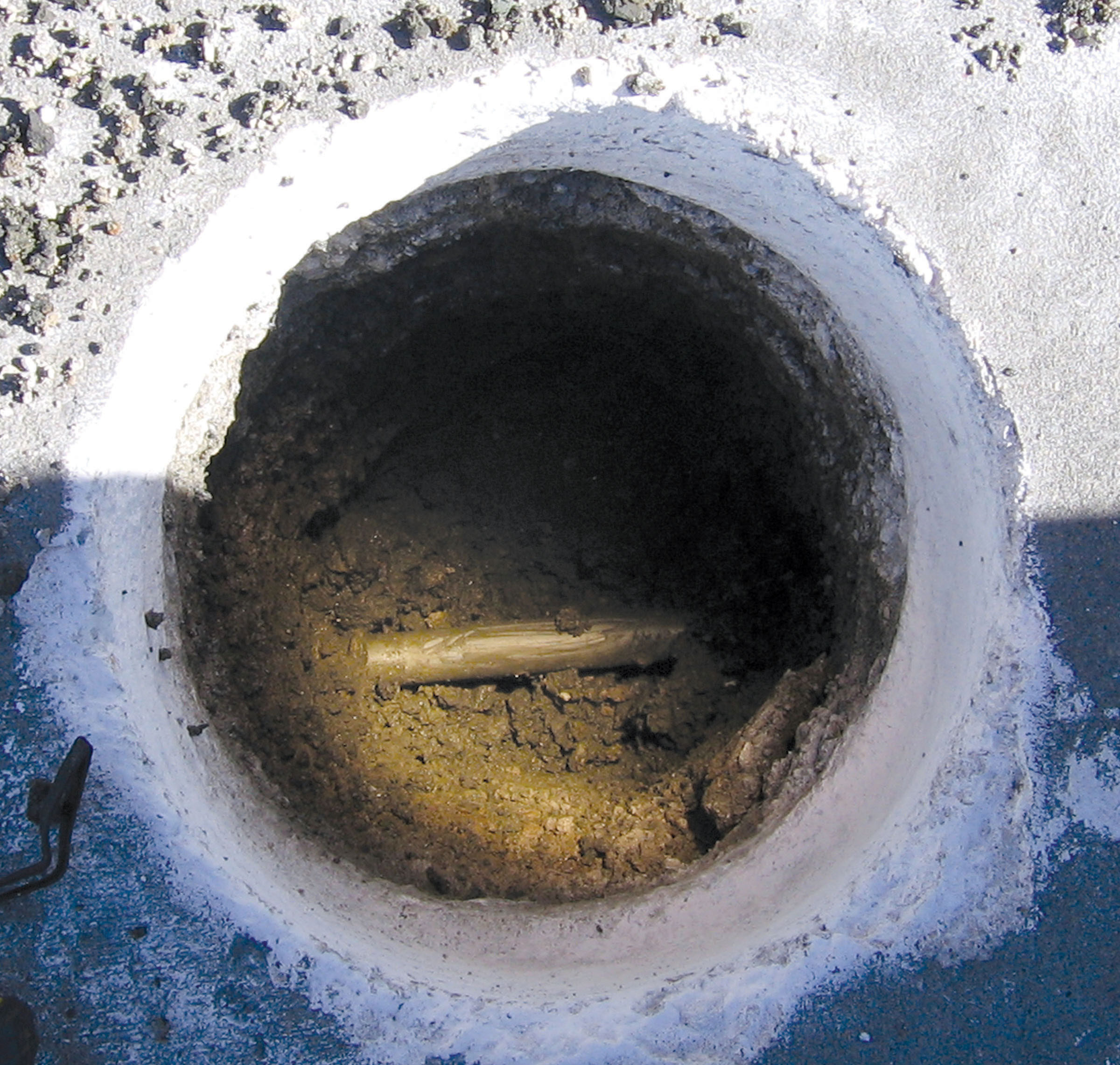
- QLA – Performing vacuum excavation at critical points to determine the horizontal and vertical position of underground utilities
Utilities located and designated by Geotechnology are typically surveyed and mapped by the project surveyor for use in construction planning and design.
SUE Benefits
- Unexpected conflicts with utilities are reduced. The location of utilities can be determined and shown on construction plans.
- Unnecessary utility relocations are avoided. Utility information is available to designers early in the project such that potential conflicts can be avoided at the design stage.
- Safety is enhanced. Excavation or grading work can be shifted away from existing utilities. This shift reduces the possibility of utility damage, personal injury, property damage, and releases of product into the environment.
Geophysical Tools for Utility Surveying
Geotechnology uses the newest technologies for identifying buried utilities. We have extensive experience using Ground Penetrating Radar (GPR) to produce three-dimensional maps of buried utilities. Other geophysical methods used for locating buried utilities include RF, electromagnetics and metal detectors.
Geotechnology has five geophysicists that have performed studies for clients in government and private industry. These studies include an award-winning project for the Missouri Department of Transportation.
Vacuum Excavation
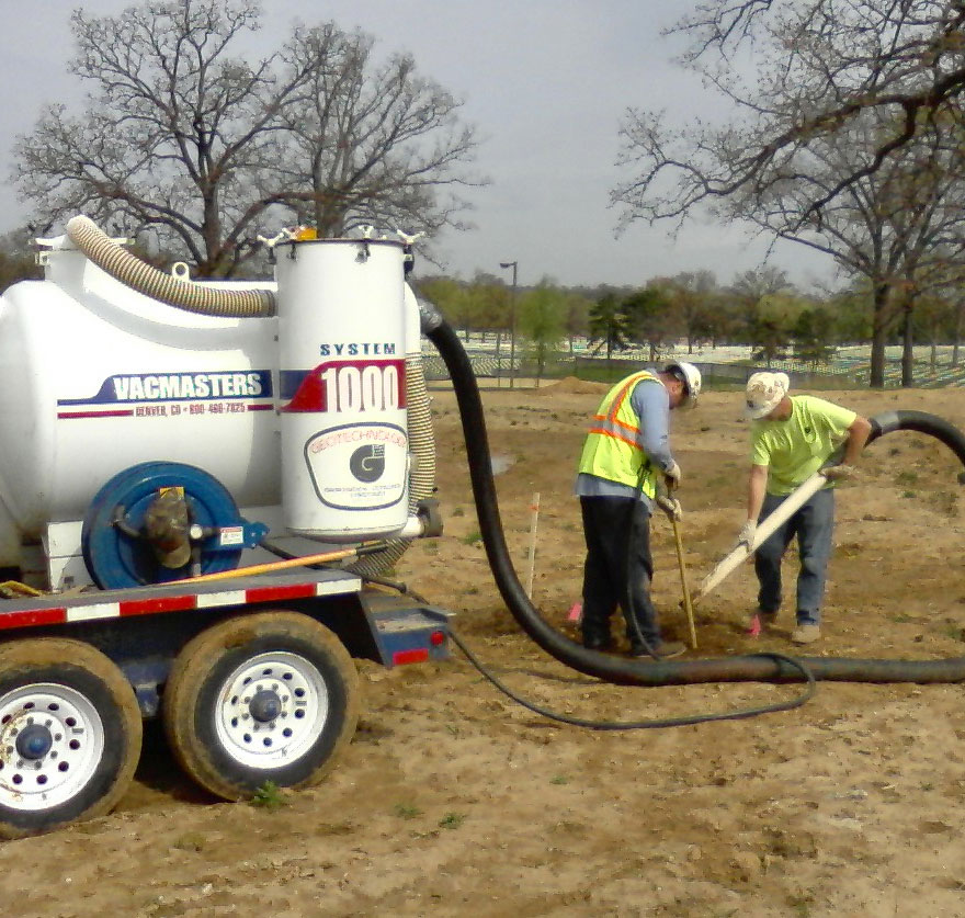
Geotechnology’s air-vacuum excavation system uses both pressurized air and vacuum to excavate potholes for subsurface access. High pressure air cuts the soil, but does not damage utility lines. The vacuum excavation method also allows an operator to safely excavate potholes with minimal risk to personnel and underground structures.
The vacuum excavation system can be used in a multitude of applications where there is a need to excavate a relatively small diameter excavation to shallow depths. In addition, work can be performed up to 200 feet away from the vacuum unit, so difficult access or interior locations are not a problem.